

Description
(viDoc device only; cases not included in order)
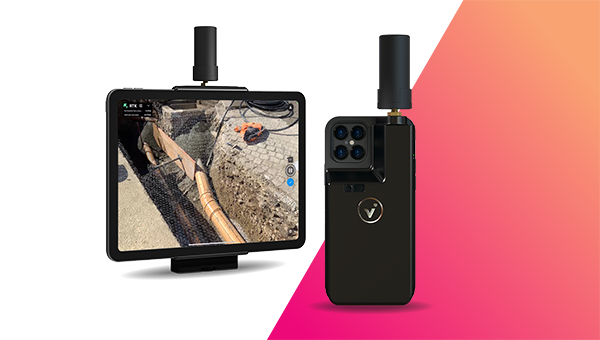
Pix4D viDoc RTK rover for selected iPhone and Android devices


The future of single point measurement with 3D scanning. Use viDoc RTK rover to document trenches with PIX4Dcatch
See how you can digitize and document trenches and as-built objects on construction sites
Multiple options for accurate point measurement
Measure with the laser, photogrammetry, or attach it to a surveying rod.

Measure obstructed points
Complete data collection without missing anything that may be obstructed by objects like trees or overhangs.

Accurate and safe measurement methods
Get your measurements and reduce risks - cut unnecessary trench visits, etc. Make data collection safer.

The viDoc RTK rover with PIX4Dcatch:
Accurate surveying with a mobile device
Unleashing the potential of RTK

Surveying underground pipelines with viDoc RTK rover
The viDoc RTK rover is saving time and improving construction workflows, boosting productivity for HSC Pipeline Engineering in Singapore.

Joint LiDAR and photogrammetry workflow for 3D bridge model
Using specialized handheld hardware for site scanning with RTK accuracy helped capture, process, and vectorize a historic stone bridge.

Which is best? The viDoc RTK or the P1 and DJI Matrice 300
How can you know whether to use a drone or a terrestrial rover - the viDoc? One team compared the results of both to test the accuracy.
Explore demo projects
Monitoring concrete pouring with viDoc <- CLICK HERE
Accurate underground mapping with viDoc<- CLICK HERE

Supported devices
The viDoc RTK rover for PIX4Dcatch is specially designed for accurately capturing 3D spaces from the ground with selected iOS devices equipped with LiDAR sensors, but also works with other selected models, including Android devices.
Get more information:
- Read the technical FAQ,
- Read the technical data specifications
- Read the product warranty policy.
Payment & Security
Your payment information is processed securely. We do not store credit card details nor have access to your credit card information.